During my first paddle with WAKE (Whatcom Association of Kayak Enthusiasts), I learned two important lessons about kayaking in Bellingham: first, that uncrowded lesser-known destinations are immensely gratifying, and second, that there are often good reasons why these spots are uncrowded.
The Salish Sea is replete with destination gems enjoyed by paddlers “in-the-know.” These special spots demand advanced skills, rough-weather experience or strategic planning. But even the easiest local put-in occasionally requires more than a light recreational skill-set. Don’t let the simple trips fool you.
That said, I’ve gathered together a few of my favorite local paddling gems. Approach them as you’d approach any kayaking excursion: expect the best and plan for the worst. And enjoy!
 1. Freshwater Slough
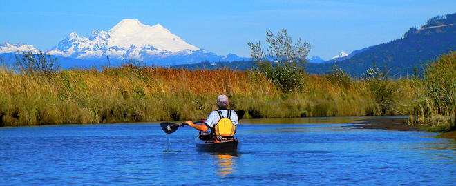
Freshwater Slough is one of many arms of the South Fork of the Skagit River. The slough is actually a delta where paddlers can enjoy an almost-intact Pacific Northwest estuary system complete with migratory geese, a variety of ducks, shore birds, eagles, raptors, Chinook salmon, otters and even the occasional seal. Sunny days boast spectacular views of Mt. Baker. During winter, neighboring fields offer breathtaking opportunities to see snow geese and trumpeter swans take flight by the thousands.
Freshwater Slough is reshaped by changing river volume and tidal flow. Low tide exposes countless sand bars; high tide leaves almost nowhere to land. The further a paddler travels downriver, the more mudflats are encountered. Trips must be timed with the tidal exchanges so there’s enough water to paddle down the slough and back up again. It’s no fun dragging a boat over mud. Watch for afternoon winds picking up from the south.
Launch Site: Skagit Headquarters

Directions: Take Interstate 5 to Exit 221, just south of Mount Vernon. Go west on Highway 534 approximately 3.5 miles to Fir Island Road, following the sign for Conway/La Conner. In 1.8 miles, turn left onto Wylie Road and follow for 1 mile to a T-intersection. Turn left, following the sign for the boat launch; the parking lot is a few hundred yards ahead.
2. Dakota Creek
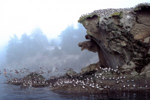
Dakota Creek empties into Drayton Harbor in Blaine. Drayton Harbor is known for extensive shallow regions that become mudflats when the tide ebbs. Countless species of birds benefit from these exposed wetlands. Loons, grebes, cormorants, herons, plovers, eagles, and ducks make Drayton a premier site for coastal birding.
Dakota Creek is located midway down the southeast side of the harbor. The entrance is an estuary dotted with homes that blend into picturesque surroundings. Kayakers must time the trip so there’s enough water to paddle inland. Maple trees, firs and cedars border the area. People fish from the mudflats and bridges. During winter months, Coho Salmon push themselves up the creek to spawn.

Paddlers travel under two low bridges, snake around shallows and pass tree stumps and snags. The inland quiet amplifies voices and the rumble of car engines. In spring the air is damp and sweet with new growth. In summer it’s alive in birdsong. Fall blankets the creek in red maple leaves. Winter is silent, icy, and laced in frost. Regardless of the season, passage becomes hampered by logjams after about a mile. The return trip is usually faster, flowing with the creek’s mild current. Kayakers will notice winds picking up as they near the harbor.
Launch Site: Dakota Creek Kayak Park, 1300 Runge Avenue, Blaine WA.
Directions: Take Exit 274 off I-5. Right on Peace Portal Drive, then sharp left on Bell Road. First right is Runge Avenue. It’s best to launch at high tide due to the hazards of mud flats. There’s a short trail down to the estuary. A second short trail leads to a viewpoint overlooking the mouth of the creek.
3. Portage Island
Portage Island is an uninhabited dot of land separated from the Lummi Peninsula by a shallow tidal flat known as Portage Bay. Portage and the surrounding areas are owned and protected by the Lummi Nation. On rare occasions when the tide is very high, the flat is submerged enough to allow low volume boats such as kayaks to circumnavigate the island. This is a pretty, 9-mile paddle with views of Lummi Island as well as Bellingham Bay and the Cascades. The remains of a beached whale on the southern end of Portage can still be seen today. Paddlers typically put in at Gooseberry Point, then travel south along Hale’s Passage, crossing to Portage Island’s western shore. From there they skirt the shoreline, circling around the island and then over the tidal flats before returning to Gooseberry. Careful planning is required to avoid long carries across the shallows of Portage Bay. Paddlers typically take lunch breaks on one of the island beaches.

Launch Site: Gooseberry Point
Directions: Take Exit 260 (Slater Road) off Interstate 5, then head west 3.22 miles to Haxton Way. Turn left and drive a little over 7 miles. Haxton eventually bends into Lummi View Drive. Look for a long dock just beyond the Lummi Island Ferry dock. There’s a small gravel parking area next to a big warehouse on the right. It’s okay to stop and unload gear, then move to park your vehicle along Lummi View Drive. Be aware that Hale’s Passage can become extremely rough, particularly when the current and wind are opposed.
4. Mud Bay
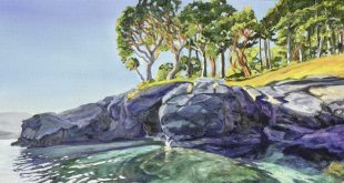
Mud Bay is an aptly named tidal basin at the Northeast end of Chuckanut Bay. Due to its broad expanses of shoe-sucking muck, paddlers don’t launch without a five- to six-foot window of high tide. Herons love this area as do other varieties of migrating waterfowl. When the tide is right, paddlers glide across the shallow bay and under a low railroad trestle, then skirt sandstone walls of the peninsula that juts into Chuckanut Bay. Rounding the rocky edge of Clark’s Point, kayakers slip into a small protected cove whose sandstone walls are eroded into artsy grooves, shallow caves, and striking symmetrical depressions that look to the naked eye like fossilized dinosaur bones or palm tree trunks. It’s a fascinating sight and well worth the sometimes rough water encountered at Clark’s Point.
Launch Site: The end of Fairhaven Avenue.
Directions: Turn west off Chuckanut Drive (SR11) at 21st Street behind the Chuckanut Bay Art and Sculpture Gallery and then immediately turn right on Fairhaven Avenue. Proceed straight to the shoreline of the bay. Park to unload gear and then drive back up the street to a small parking area on the right.
5. Boulevard Park: East Beach
Boulevard Park is one of Bellingham’s signature locations built on a strip of land along South State Street and Bay View Drive. Established in 1980, the park is a favorite for sunset strolls, coffee breaks, sports activities and concerts in the summer. Lesser known is the tiny beach at the east end of the park just past the open staircase that climbs up to State Street. Kayakers park as close to the stairs as possible for a short carry to the beach. The beach and its small cove are sheltered from southern winds, providing a safe haven for tired paddlers. It’s a short paddle west to Fairhaven or east toward Cornwall Park and on to Squalicum Harbor.
I was sold on this put-in several years ago when I slid into the cove and paddled around the corner for a perfect view of a rock concert. Not only did I have a ringside seat near the pavilion, I also enjoyed the added benefit of bobbing and paddling to the beat. Another time, I got a hankering for coffee at the start of a paddle. A quick call to Woods Coffee (at the other end of the Park) resulted in a steaming mocha handed across the water. There’s nothing like coffee in a kayak.
Launch Site: The east end of Boulevard Park, past restroom facilities and the stairs.
Directions: From S. State Street, turn west on Bayview Drive, drive down to the park, cross over train tracks and continue to the far end of the parking lot.
6. Whatcom Creek Estuary
Whatcom Creek flows 2.7 miles from Lake Whatcom into Bellingham Bay. The estuary is formed by the lower falls under the George E. Pickett Bridge next to the downtown post office on Prospect Street. Maritime Heritage Park flanks the south side of the estuary and a fish hatchery run by Bellingham Technical College is on the north side.
Under the right conditions, kayakers enjoy paddling up the Whatcom Waterway past one or two ships moored at its entrance. When the wind is up, refracting waves can challenge less skilled paddlers. Further up the channel, harbor seals are often seen lazing on log booms and poking their heads up in the water. Timing is everything on this excursion. Kayaks must pass under the Roeder and Holly Street bridges as well at the Burlington Northern railroad trestle without being shut out due to high tide or beached on a sandbar when the tide ebbs.
Launch Site: Any kayak launch point in Bellingham Bay. (See Boulevard Park East Beach.) Beware of changing conditions in the bay. The Whatcom Waterway’s entrance can become very choppy and confused.
7. Lake Samish
About 6.5 miles southeast of Bellingham, Lake Samish offers an easy experience of suburban country paddling. The lake is surrounded by private homes with a lovely 39-acre public park stretched along its northwest border. Kingfishers are often seen the area despite considerable recreational boating in the summer. Fall and winter months are most appealing to paddlers.
The lake is approximately 6 miles in length, divided into two sections by a bridge. The east side is longer and noisier as it parallels Interstate 5. The west side is quieter and much smaller—about 1.75 miles around—including the park at its northwest corner next to the bridge.
Launch Site: Paddlers can leave vehicles all day in the park’s free public parking lot next to the bridge; however, boats must then be shouldered down a steep walkway through the park before reaching the water. The Department of Fish and Wildlife maintains a second launch point located on the east shore that’s often easier to use.
Directions: Take Exit 242 off Interstate 5 and go west for 1 mile. Turn right on Old Samish Hwy. After approximately 1.2 miles turn left into the access area. Unload at the small concrete boat launch and park in the flat gravel area next to it. Washington Discover Pass parking permits are required.
Hard Lessons
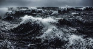
On my first excursion with WAKE, we visited a lovely private beach around the north end of Lummi Island. It was a warm, sunny morning and I was still a newbie. As we crossed the smooth waters of Hale’s Passage, I wondered why I didn’t see more kayakers out and about. There was a little chop around the headland but it was fun. I didn’t know that Hale’s Passage is notorious for afternoon waves and current. The return trip was a nightmare. Every moment was filled with a sense of dread and desperation. Steep following seas convinced me I was going to capsize. My skilled companions shouted encouragement but I vowed that if I made it back to the car alive, I’d never sit in another kayak.
The next week I was taking paddling lessons.
A year later we visited the same beautiful spot in similar sunny conditions. As we rounded the headland back toward Gooseberry, my heart pounded so hard it felt like my ribs were vibrating. Lo and behold, flat water. I’ve yet to experience those same nasty circumstances in Hale’s Passage. No matter – when it happens, I’ll be ready.
Easy paddles aren’t always easy.
Lake paddling is deceptive. Without tides and currents, kayakers can be lulled into a false sense of security. As with any body of water, lakes have their own weather issues. I discovered this one sunny afternoon on Lake Samish. My buddy and I were paddling along the north shore when an inky black cloud started rolling toward us, churning whitecaps and obscuring everything in its path. “Let’s get back to the car!” I yelled. We spun our boats and raced for the take-out but the storm slammed us broadside. We were practically blinded by sheets of rain. My foredeck seemed buried in steep short-interval waves. I leaned hard into the wind, bracing and paddling. As we both neared exhaustion, the sun appeared and it was over. Stunned, we watched the storm roll down the lake, blowing up and over the mountain. Our remaining time on the water was trouble free.
Kayaking Rules to Live By
- Always paddle with at least one other person. It’s more fun to share experiences with friends and you’re adding a significant margin of safety.
- Do your homework and know how to paddle the conditions you might encounter. For example, when you’re crossing Hale’s Passage, know that you have the skill and gear to return safely if the weather kicks up.
- Leave extra time to stay put if necessary. Whether it’s a day-paddle or an overnight excursion, you don’t want to be forced to paddle in conditions over your head…literally.
- Share your float plan with family or friends. Loved ones become stressed if they don’t know where you are. Keep your cell phone charged to make those reassuring phone calls.
- Expect the best and prepare for the worst. Extra food and clothing are essential for any kayaking adventure but they become especially important when visiting remote or hard-to-reach locations.
- For more safe paddling advice, visit the WAKE website at wakekayak.org.
 Dawn Groves is a consultant who helps managers and business leaders develop their teams and handle their own work pressures. She’s also a writer and an enthusiastic kayaker. Visit her blog: When Work Goes Sideways