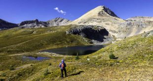
Table Mountain
The trail that climbs to the top of Table Mountain from the bustling parking lot at Artist Point is a dream come true for hikers who have only a few hours to commune with the Mountain Gods. The climb—zig-zagging up the cliff—is steep and somewhat exposed in places, but it’s only a half mile (600’ of elevation gain), granting access to the top of the table, where a scenic feast awaits. Once on top, it’s easy going across sublime sub-alpine terrain through heather meadows and past shimmering tarns that reflect the surrounding peaks: Shuksan, Baker, the Border Peaks, a who’s who of local monarchs.
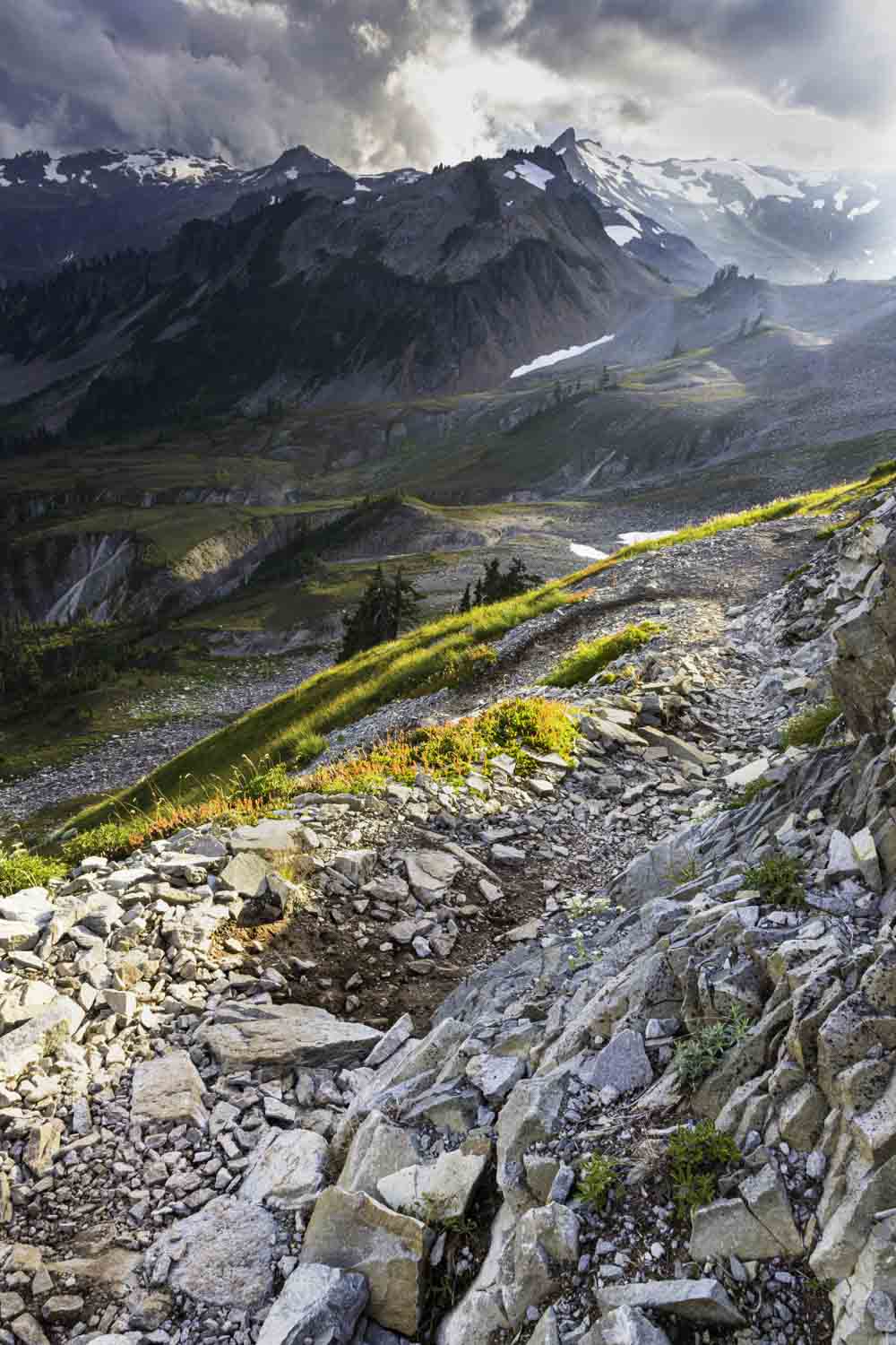
Trailhead: Drive WA-542 (the Mt. Baker Highway) 58 miles east from I-5 in Bellingham, bearing right near the Upper Mt. Baker Ski Area Lodge for 2.6 miles to the Artist Point parking lot. Northwest Forest Pass Required
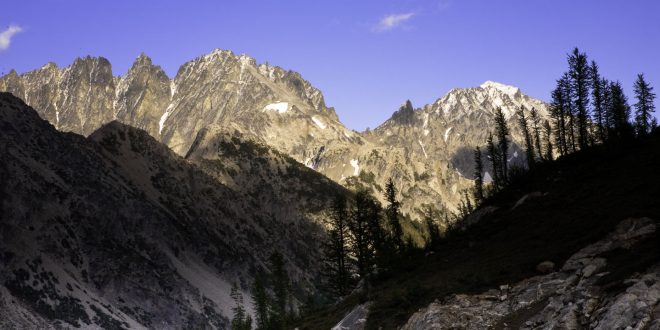
Spider Gap
Spider Gap is a grand Cascadian threshold. Dividing the parklands of Spider Meadows from the ice and tumult of the Lyman Lakes, it’s a compelling place. To get there, you’ll hike 5.5 miles (with several potentially “interesting” stream crossings along the way) up the Phelps Creek Trail (gaining 1500’) to lovely Spider Meadows. Turn left (north) on the Spider Gap Trail and climb another thousand feet in a mile to Larch Knob, an exquisite viewpoint. Fred T. Darvill described it as “one of the most splendid campsites in the North Cascades.” Having camped there myself, I can readily agree. If you pitch your tent on the Knob, you can explore the high divide between the meadows and the glacier at your leisure. There’s no real trail, but the way is obvious enough. Take care not to walk on the vegetation. Take your time. There’s a lot to see.
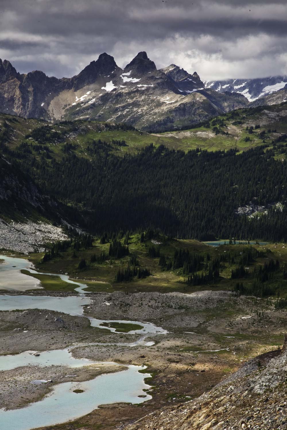
Trailhead: From Stevens Pass, head east on US2 for 20 miles, North on WA-207, bear right on Chiwawa Loop Rd. Turn left on Chiwawa River Rd. for 22 miles, bear right on FR-6211 for 2.3 miles to the trailhead.
Pedley Pass
The Kootenays have been an under-the-radar destination for a long time, British Columbia’s best-kept secret. To be sure, a visit to the Kootenays often includes a commitment: long, bumpy 4-wheel drive, high-clearance approaches to the trailheads. The Pedley Pass Trail, near the town of Invermere, is no exception. This 6.5-mile loop features a wild, rugged ridge walk with heart-stopping views out over the Rockies and Purcells and down into the Columbia and Kootenay River Valleys. You’ll climb a well-maintained trail (total elevation gain is 2300’) to the spectacular ridge and then traverse the giddy knife edge. Awe is pretty much guaranteed.
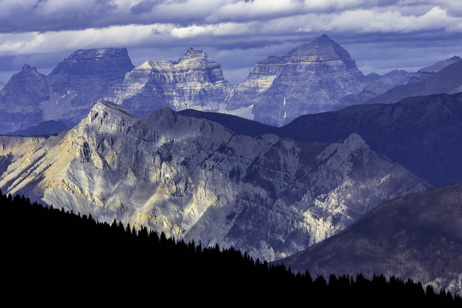
Trailhead: From Invermere, BC take HWY 93/95 south, turn east onto Windermere Loop Rd. Follow for 3.3km, turn left towards Westroc Mine Rd. and immediately turn right onto Westroc Mine Rd. Keep right at the fork at the 8km marker to stay on Westroc Mine Rd. Continue to the trailhead at the 21km marker. 4WD High-Clearance vehicle required.