
Washington State Route 11, also known as Chuckanut Drive, is a beautiful scenic byway that never makes the cut in lists of America’s great scenic drives. Perhaps, at 21 miles long, it isn’t epic enough to rate. But as an experiential journey, it is easily one of the finest ribbons of road in the United States. It is a gorgeous drive that transports visitors to some of the most enchanting roadside attractions in the Pacific Northwest.
There was talk of abandoning the entire road project… Perhaps this panoramic jewel was simply too expensive to keep.
I may be biased because I live very near the terminus of Chuckanut Drive, and I’ve traveled it many times. For some perspective, I have driven many breathtaking scenic roads in my day, from North America to Europe, the UK, and Japan. I’ve toured mountain passes, spectacular bridges, desert scrub, deep forests, and rugged coastlines.
All this, and I still rate Chuckanut Drive as one of the most glorious byways, not just in America—but in the world. And it’s right here, in our backyard. Let’s look at this road’s history; then, we’ll take a quick tour.
The Project

The creation of Chuckanut Drive can be traced back to 1864 when a new telegraph line ran along the Chuckanut coast. Telegraph lines require telegraph roads, and Chuckanut was no exception. That said, calling the Chuckanut telegraph pathway a “road” was a bit of a stretch; it was a muddy, poorly maintained trail.
In 1890, the pathway was widened for use by light wagons, acting as a modest connector between Skagit County and Fairhaven. Back then, the only other connector between Whatcom and Skagit was the Old Samish Lake Road, a primitive horse path through thick forest. The coastal wagon road, if improved, could become a viable link for Whatcom residents, whose only methods of connecting to the rest of the USA were by horse or by sail.
In 1891, Whatcom County approved the construction of a hardened road along the telegraph wagon road from Fairhaven to the county line near Clayton Beach. In 1892, using their own funds, the owners of the Roth Rock Quarry (what we now call Teddy Bear Cove) commissioned a team to pave the road from Fairhaven to their quarry. It was completed in February, easing the transport of rock on the short trip to town.
The rest of the coastal wagon road, then known as the Old Blanchard Road, was functional yet woeful. On the Skagit end, high tide regularly flooded the road. Travelers had to wait out the tide to proceed. The bulk of the route from Colony Creek to Teddy Bear Cove was a rutted, muddy mess. To make matters worse, in 1901, Skagit County sold the southern three miles of the Old Blanchard Road to the Great Northern Railroad as a cutoff for their Burlington to Bellingham rail line. It seemed this would be the end of the great coastal connector.

The sale was disastrous, but Whatcom County was a very vocal community. Whatcom residents made a hue and cry to reclaim Old Blanchard Road. The May 18, 1905 edition of the Anacortes Telegraph proclaimed:
“It is out of the question for the isolated people of Whatcom County to get into the United States on dry land without driving through Skagit County, but there is no roadway connecting the two counties. Of course, Whatcom County has roadways extending into the British Columbia territory, but it is not to be presumed for one minute that this important province of Great Britain would be willing to annex this adjacent territory. Therefore, Bellingham and Whatcom County is an isolated community. It is practically cut off from the United States, and British Columbia wouldn’t claim them for anything in the world.”
As the automobile and bicycle became popular in the United States, Bellingham business partners Cyrus Gates and Charles X. Larrabee lobbied Washington state to commission a proper coastal road to replace the Old Blanchard Road. They felt it would be a great scenic drive and a vital economic link for Skagit County farmers.
The Anacortes Weekly American agreed, writing in April 1907: “Those fellows up that way are determined to have that little lover’s lane and automobile path to Chuckanut Bay and the oyster beds if it takes all summer. Well, it is all very well, let ’em build it, so as Bellingham can give us a market for our surplus cattle, oats and hay.”
Construction began in 1910, using convict labor at a camp on Oyster Creek. The convicts cleared only about a mile of usable road before the money ran out. After public pressure, the state Highway Department commissioned the Quigg Construction Company to finish four more miles of the road in 1913. They did this, sloppily. They rained enormous rocks onto the railway below, stirring an angry Great Northern Railroad to sue the state. The state settled and decided to do the work itself rather than rely on inept contractors.
Unable to fully commit the manpower, the state eventually signed a contract with builder S. Murchison. His team widened the road from 16 feet to 20 feet and constructed concrete trestles and retaining walls on some of the hairier parts of the roadway. It was painstaking progress, with workers blasting and cutting into the stone ledges, then carefully hauling away each giant block for disposal or re-use.
The Highway Department and its contractors finished the road in 1916 when it was officially made part of Pacific Highway 1, stretching from the Canadian border to San Diego, California. It was still mostly gravel, with a few sections properly paved, but the road was finally opened to automobile traffic. At the time, Chuckanut Drive was the only segment of the Pacific Highway to parallel the Pacific Ocean directly.
The full paving of Chuckanut Drive from Fairhaven to Blanchard wouldn’t be completed until 1921 and came as a huge relief to the growing population of bicyclists who enjoyed the scenic ride. It took another sixteen years to replace the old wooden bridges with concrete spans over Padden Creek, Oyster Creek, and Blanchard.
Chuckanut Drive was now a popular and critical highway for both recreational touring and Skagit-Whatcom commerce. But its status would soon be usurped by the new U.S. Route 99, wending its way from Burlington to Alger, along Lake Samish and Lake Padden, and north into Bellingham.

Completed in 1931, Route 99 was the modern solution, and it relegated Chuckanut Drive to being what it is today: a byway. With the loss of its prestige, attention, and investment became precarious. Severe landslides occurred in 1930 and 1937, but road crews addressed them within days or weeks. A massive landslide in May 1976 nearly doomed the road to permanent closure. A portion of the road near Clayton Beach that had settled and cracked two years prior finally gave way. That section of Chuckanut Drive completely collapsed and fell down the mountainside.
There was talk of abandoning the entire road project. It seemed the forces of nature and physics would make the scenic drive a poor investment. Perhaps this panoramic jewel was simply too expensive to keep.
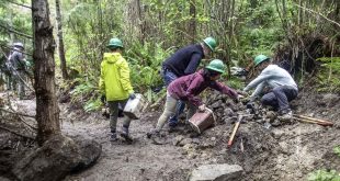
In the end, democracy prevailed. Public cries to rebuild the road fell on ears beholden to voters, and the laborious task of rebuilding Chuckanut Drive commenced. It took five months of painstaking labor. The Tripp Construction Company carried away massive chunks of rock, hauled in untold tons of fill to bolster the new roadway, and then constructed a concrete retaining wall anchored to the cliff with massive metal bolts. The road was officially re-opened in October of 1976.
Along the Way

Chuckanut Drive still suffers from regular rockfall. These incidents close the road for days, sometimes weeks, but the road always re-opens due to its ever-growing popularity as a scenic drive and the fact that many motorists depend on it for commuting.
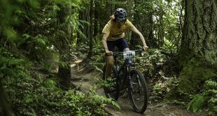
Chuckanut Drive remains an awe-inspiring experience for locals and tourists. Leaving Fairhaven, you can visit Arroyo Creek or the bucolic fields of Woodstock Farm. Then comes Teddy Bear Cove, where the nudists that once gathered there may have fled, but the stunning rocky shorefront remains. As you pass Hiline Road, you descend into thick forest, where a cathedral of green hugs you close, and sunlight dapples in starry strobes.
Further on is Larrabee State Park (the first state park ever designated in Washington!) with its campground, easy trails, and half-moon beach. To the east is the busy Fragrance Lake Trail, a beautiful day hike with a spectacular overlook as a reward for your labored climbing. The Lost Lake/Clayton Beach Trailhead lies a bit further south. From here, a newly re-engineered trail transports hikers three-quarters of a mile to beautiful Clayton Beach, one of the finest places on Earth to watch the sunset on a summer evening. A Discover Pass is required to park at both the Fragrance Lake and Clayton Beach trailheads.
Further down the road, you’ll find Dogfish Point and View Point, which offer drivers a chance to pull over and see the spectacular coastal vistas without needing to hike anywhere.
As you venture further, it’s a good idea to slow down for the narrow cliffside section and the radical hairpin turn at Taylor Shellfish. If you survive that, you’ll find yourself at the Oyster Bar, whose fine seafood warrants a stop. Those more prone to packing gorp in a backpack should head up the Oyster Dome trail, where a long set of arduous yet pleasantly forested switchbacks lead to the Samish Overlook, where you might see some hang gliders taking off for a long soar over the Skagit flats.

Finally, you blaze south to the elegant Chuckanut Manor restaurant and over the Colony Creek bridge, where the forest abruptly ends, and the vast flat farmlands of Skagit appear. If it’s April, you are likely heading to the Tulip Festival, so bring your camera. If it isn’t April, you may be heading to Edison for a quiet stroll on its quaint Main Street. If you need to continue on to Burlington, Chuckanut Drive becomes a long straight ribbon slicing through pastoral farmland, replete with wide-open sky, quaint farmhouses, and occasional farm equipment lumbering down the road at a stately pace.
Chuckanut Drive may not make America’s Best Scenic Drive lists, but that is more of a foolish oversight than a value judgment. If you haven’t taken Chuckanut in a while, I’d recommend you strap in the family and re-discover it.
 A longtime member and chairman of the Bellingham Greenways Advisory Committee, Ted Rosen can often be found on local trails complaining about litter. He is also a skilled guitarist and a student of history