
I noticed once that if you turn a map of the Salish Sea about 90 degrees counterclockwise, squint with one eye, and allow for some abstract deformity, the general outline of our great inland sea resembles the head and neck of a great blue heron. Vaguely anyway. It’s not a bad metaphor in a place with so many of these iconic birds.
On my crooked imaginary map, the stately bird’s broad beak (Georgia Strait) points left toward Canada. The occipital plumes behind the head are the waterways that gather around Whidbey Island, where tides ebb and flow like a heartbeat through Puget Sound and Hood Canal. Rising from the Pacific Ocean, the gently curved neck leads up the Strait of Juan de Fuca to the bird’s eye, the San Juan Islands.
So, beak, occipital, neck. Viewed from Low Earth Orbit, that’s more or less how I imagine the sea’s amorphous geography. Or maybe it’s just a sprawling blob, a cosmic heron splat, with an annoying international boundary running through the middle.

No matter how you slice it, the Salish Sea is a big place. It’s not easy to neatly organize the entirety of that sprawling blobness in one’s noggin. Since they’re closer to home, I can orient myself well to Washington’s northern waters—Bellingham Bay, Rosario Strait, the shores of the San Juan Islands, Whidbey, Fidalgo, and Camano Islands. The major straits, sounds, channels, and bays form the major bones within my sense of place.
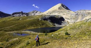
As for the heron’s “beak,” the shores in and around White Rock and Vancouver are also quite familiar by now. The rest, from the Gulf Islands to Campbell River and Discovery Passage, not so much. I cruised the entire Strait once with friends and have kayaked here and there, but the vagueness sets in beyond the joyful hubbub of the big city. In the fall of ’23, after a fabulous Coast Range hike to St. Mark’s Summit with its jaw-dropping view of Howe Sound, I realized how vast the possibilities are for taking in the grandeur of B.C.’s allotment of the Salish Sea. So return I must.
As with the beak, the “occipital” part of the Salish Sea’s delicate plumage leads southward to a more mysterious world of convoluted passages, inlets, bays, coves, and estuaries. I wish I knew it better. Perhaps our friends in Olympia (or Campbell River, for that matter) feel the same about our neck of the woods, er, sea.

To the Coast Salish people, these waters were their superhighways, main drags, and backroads for thousands of years. Wide open, uncrowded, entirely free of stop signs and parking meters. Countless Native American camps and villages once lined the more than four thousand miles of coastline surrounding this great inland sea.
Today, we can hustle about the region in our noisy boats or motorized land canoes to reach many of the same places that others hunted, fished, and enjoyed for millennia. If we’re lucky, we might even stumble on places that remain virtually unchanged from what the true canoe people experienced centuries ago.
To really get to know our inland sea, maps are one thing, but there’s nothing quite like a good walk on the water. Not in the biblical sense, but in the wait-for-the-tide-to-go-out-and-take-a-stroll sense.
In any case, here are some personal favorites among the largest, most accessible islands in our northern waters:
Whidbey Island

Possession Point State Park (south of Clinton)
Our timing on a midday Tuesday in January couldn’t have been better. Clouds parting. Sunbeams illuminating the sheer bluffs—outbound tide. Eagles chittering. Sea lions puffing and bobbing for brunch. A fine place to imagine the untrammeled wildness of the Salish Sea coast long before the arrival of Euro-Americans. And just us to soak it all in. (Expect some company in nicer spring weather.)
The ebbing tide was around five feet when we visited, and we had no difficulty reaching the park boundary in just 0.3 miles. The bluffs are prettiest in morning light. Dangerous slides can happen, so stay back from the base.
The park is a short drive from the Mukilteo-Clinton ferry dock. Follow SR 525 west 1.5 miles, go left on Campbell Rd. and left on Cultus Bay Rd. Continue on Possession Rd. to a hairpin turn, then take the first right onto S. Franklin Rd. (The second right goes to Possession Point Waterfront Park, managed by the Port of South Whidbey.) Limited parking; Discover Pass required.
For just the beach, descend the path on the left. If you’re up for a steep, twisty-turny hike to a view of Puget Sound and Mount Rainier, take the path on the right for a 1.4-mile loop. The loop descends to the same pebble-cobble beach. Continuing on the loop, look left for Mount Baker, with snowy Three Fingers and Whitehorse Mountains rising above Possession Sound.
In the spring of 1792, Captain George Vancouver claimed “possession” of these lands and waters for King George III. The native people later responded, “Vancouver failed to realize that these lands had been the Northwest Coast natives’ homelands for thousands of years and were not available as a birthday gift for the King.”
Double Bluff (west of Clinton)

With a walkable beach more than two miles long, Double Bluff is an easy add-on to a visit to Possession Point, best, of course, during lower outgoing tides. This Island County Park is pet-friendly and mostly off-leash (beyond the wind sock). The modest parking area fills up on nice weekends any time of year. From the Clinton ferry dock, take SR 525 for 10 miles and turn left on Double Bluff Rd. The park is two miles ahead.
With or without Fido, the beach offers an excellent stroll below eroding mega-bluffs over 300 feet high and a soothing place to putter. Just do your puttering away from the base and keep an eye on the tide tables if you venture far. Shutterbugs might prefer morning sunlight on the bluffs and the Olympic skyline, although winter/spring sunsets can also be quite fabulous.
An interpretive sign tells the story of how the bluffs were originally deposited by massive glaciers and worn away by the sea for thousands of years. The higher easterly bluff diminishes in height after 1.5 miles. Just around a sharp point, the northerly bluff begins to rise.
Useless Bay riffles to the southeast, with a proud Mount Rainier (or Tahoma, the “Mother of Waters”) dominating the horizon. If it’s clear enough, you might notice downtown Seattle’s spiky cluster of buildings. At lower-low tides, the sandy beach extends far from shore into Useless Bay—“useless” only because it’s too shallow for ships. Canines (and their owners) will heartily disagree.
Ebey’s Landing (Coupeville area)
Perhaps the best-known seashore on Whidbey Island, Ebey’s Landing National Historic Reserve near Coupeville is also among the most heavily visited, with up to a million visitors annually. That’s right up there with Deception Pass State Park (below) at over two million. I’ll presume many readers have already been to Ebey’s Landing, but if not, it belongs on your bucket list.
There are at least 30 miles of trails in the vicinity. To sample some of the best while fulfilling your life’s purpose to become better acquainted with the charms and channels of the Salish Sea, aim for either the main beach parking area at Ebey’s Landing State Park just off South Ebey Rd. (Discover Pass required), or park at the Prairie Overlook to enjoy an easy 0.8-mile walk to the edge of the bluff, if not the world.
One can partake in a majorly scenic trek along the 200-foot high bluff from either location above or below the meadowy rise. A switchbacking path connects the bluff’s rim to the beach. The entire loop is about 5.5 miles long, starting at Prairie Overlook or just under four miles starting at the Landing.
The area is named after the unfortunate Colonel Isaac Ebey, considered the original settler of the island in 1850. Ebey was a highly respected leader and influencer who served in the Oregon and Washington Territorial legislatures.
In the summer of 1857, a party of northern natives, possibly Haida or Tlingit, canoed here to avenge the attack and killing of as many as 28 Indians, including a chief, by the Navy crew of the USS Massachusetts. The Navy was responding to prior attacks on Coast Salish natives and sought to hold the invaders accountable. But one tragedy invoked another, and so on, it would seem. Intent on taking the life of a white “chief,” the northern invaders arrived at Ebey’s dock on a warm August evening and marched up the bluff to his house. When Ebey came out to talk, they shot him, then promptly detached his head.
There’s a rich history here, but not all of it is blood and gore. Watch for interpretive signs and displays at various locations.
Deception Pass
The Deception Pass area, where the north end of Whidbey Island meets the south tip of Fidalgo Island, is excellent for coastal carousing. The best view of the sea from Deception Pass State Park is from the big steel-arch bridge across the deep, narrow channel. A skinny walkway runs along either side. This is SR 20, so big trucks and RVs with extra wide side mirrors should keep you on your toes. Just don’t stand too high on those toes when leaning over the guardrail—it’s a long way down (180 feet) to the churning current below. The park has many trails to choose from, plus a couple of lovely beaches and a campground (Discover Pass required).
Fidalgo Island

Aim for the relatively short hikes on the Fidalgo side of Deception Pass to Lighthouse Point or Rosario Head from Bowman Bay for more expansive views. If you’re adventurous and sure-footed, windy periods can produce impressive scenes of waves crashing on rocks.
Sharpe Park
North of Bowman Bay, another great trail to check out is at Skagit County’s Sharpe Park. The trailhead is on Rosario Rd. 1.7 miles north of SR 20. Looped trails lead among woods and wetlands high above Rosario Strait. Aim for Sares Head to look across an enormous expanse of the Salish Sea, including almost the entire east half of the Strait of Juan de Fuca.
Fidalgo Head
The high overlook from Washington Park at Fidalgo Head due west of Anacortes (via SR 20 and Sunset Ave.) is less remote and more visited than Sharpe but equally stunning. A one-way scenic drive or bike ride circles the headland, intersecting trails, beach access, a campground, and viewpoints. At the high point of the circuit, the Burrows Channel Overlook is pretty special. A hike around the outer headland provides a quieter spot to contemplate the seascape.
Camano Island

On Camano find two state parks, several nature preserves, and county parks with trails that meet the sea. The twin state parks of Camano and Cama Beach on the west shore are obvious places to commune with the Salish Sea. At the former, openings along a forested rim trail traversing the bluff offer excellent views across Saratoga Passage to Whidbey. In 1949, nearly a thousand volunteers built this park in a single day. Cabins and camping are also available. The venerable cabins have closed at Cama Beach, a former fishing resort, but a suitable beach and miles of upland trails are primary attractions.
From Stanwood, head west on SR 532 across the big bridge and keep left at the traffic light. Both parks are easy to find near the south end of West Camano Dr., roughly 12 miles from Stanwood. Beware of hellish traffic at times, as there is only one road for 20,000 people to get on or off the island. Grit your teeth and go anyway.
Barnum Point

On the morning side of the island (that would be east), Barnum Point County Park has an excellent trail system along a forested bluff, plus wide-open views where the old Barnum farm once existed. A few interpretive signs share the story of this beautiful place. Trails access a walkable beach at lower tides. Credit the Friends of Camano Island Parks for the tireless volunteer work that helps make these places a joy to visit. From East Camano Dr., turn east on Russell Rd. and right on Sunrise.
Iverson Spit Preserve

Just before the entrance to Barnum, a left on Iverson leads to this intimate nature preserve. It’s good for birding and offers a kid-friendly “Hobbit” loop (may be muddy in spring) and a pleasant walk on a dike overlooking Port Susan and Livingston Bay. While visiting, I was entertained at length by a great blue heron balancing on a bobbing log, apparently riding the ebb to some other fine shore in Heronville.
 The author and publisher of Hiking Snohomish County (2024), Hiking Whatcom County (2023), and Hiking Island County (2025)” Ken Wilcox is a long-time Bellingham resident, writer, and professional trail planning/design consultant. He writes about parks, trails, Northwest history, and travel and frequently posts his work via Substack at www.kenwilcox.com