AdventuresNW



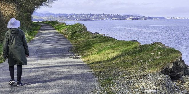
The saying, “Build it, and they will come,” is true: the Olympic Discovery Trail, with nearly ninety-five miles already completed, is a magnet for walkers, hikers, and bikers. It wanders through evergreen forest, crosses over gently flowing rivers, stretches along pristine lakeshore, traverses prairie farmland, and borders lovely marine shoreline. This multi-use pathway highlights incredibly scenic portions of the Olympic Peninsula. Locals call it the “ODT.”
The path cuts across Johnson Creek on a captivating, 410-foot-long, curved railroad trestle. Eighty-six feet above the creek, this spot demands a stop to take in the tree-filled surroundings.
The path began as a railroad route in 1847, part of the Chicago, Milwaukee, Saint Paul, and Pacific Railway, better known as the “Milwaukee Road”. When operations ceased in 1985, the railroad bed became a prime candidate for the “rails-to-trails” program.
Planners conceptualized a picturesque, 135-mile pathway inviting visitors to cross the Olympic Peninsula from Port Townsend to La Push, inspiring the name “Olympic Discovery Trail.” Putting the route together, however, would be complicated. Just taking into account who owns the land—figuring out who trail planners need to work with—required making connections with county government, city government, state park officials, tribal councils, and various individual landowners. It seemed everyone had a piece of the trail. A master plan with a clear vision was needed to coordinate these efforts, and that’s how the Peninsula Trails Coalition came to be.
“The course was envisioned 37 years ago, and when the coalition set out to acquire tracts for the pathway, they didn’t begin at mile zero and add west,” explains Jeff Bohman, past president of the coalition. “Different sections all across the proposed path were acquired. Our enduring faith was that over time—one by one—all the pieces could eventually be connected, all the gaps filled in. So, it’s a concept that is a work in progress.”
Trail sections exist in Port Townsend, but the contiguous portion of the ODT begins at the west side of Discovery Bay, connecting conventional asphalt bike lanes, little-used paved backroads, and crushed gravel paths, stretching all the way west to the Elwha River. The path, separated by a wide stretch of greenbelt thick with Douglas Fir, Madrona, and assorted native brush, runs parallel to Highway 101. Although you can hear highway traffic whizzing by, you can’t see it, and you have a sense of biking down a practically deserted road tucked in among tall trees.
Backroads curve lazily through the woods approaching Sequim Bay, where the ODT crosses into Jamestown S’Klallam tribal land. The byway provides a lovely sea level marine view as it wraps around the south end of the bay, eventually entering Sequim Bay State Park. This curvy, up-and-down section of the trail is a lot of fun, wiggling around campsites and offering glimpses of the bay.
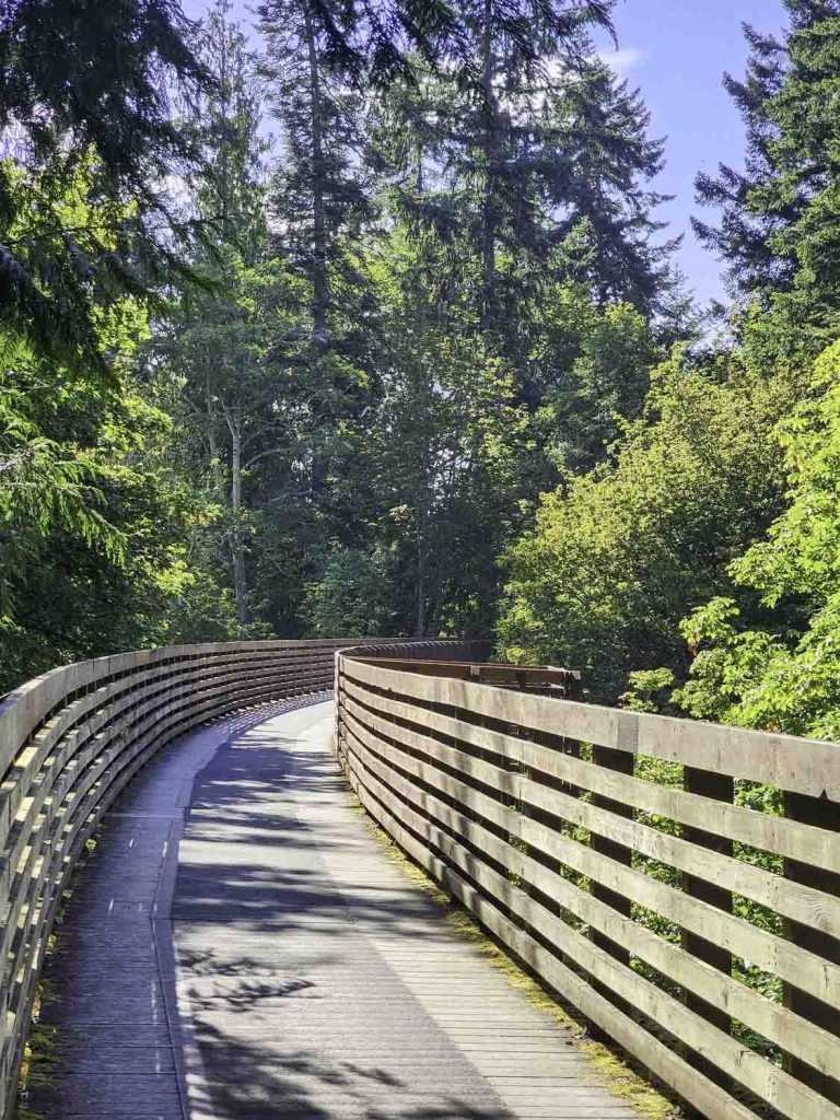
Continuing west, the path cuts across Johnson Creek on a captivating, 410-foot-long, curved railroad trestle. Eighty-six feet above the creek, this spot demands a stop to take in the tree-filled surroundings.
Miles of forest then open up to prairie land as the route approaches the town of Sequim. After passing Carrie Blake Park, the path’s personality changes from prairie to residential as it traverses the western part of town. It’s not very far until you are back to verdant ground.
The trail crosses Railroad Bridge Park, next door to the Dungeness River Nature Center, and proceeds over a 780-foot-long restored timber truss and trestle bridge. With the Dungeness River flowing underneath, this stretch of trail invites reflection.
The ODT meanders through farmland and past grazing cows in the Dungeness Valley, then continues westward to Deer Park Overlook, where views of the Olympic Mountain Range emerge.
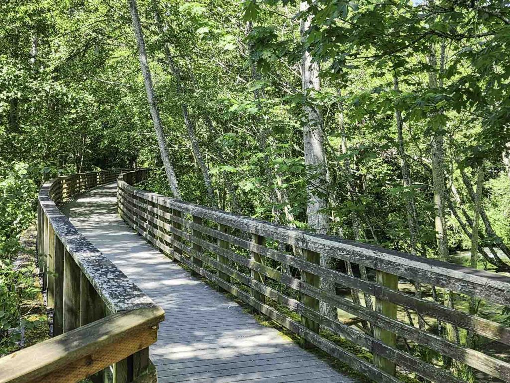
Another railroad trestle spans Morse Creek. The restored bridge is surrounded by tall maples and alders, whose arching branches form a green overhead canopy, creating a dappled patchwork of shade and sunlight on the asphalt surface. Birds sing, the creek flows nearby, and green surrounds you: gooseberry plants, salmonberry, nettle, maidenhair ferns, sword ferns, and young maple trees. One minute you are enveloped in all this vegetation, and the next you are staring at the shores of the Strait of Juan de Fuca, the Salish Sea’s outlet to the Pacific Ocean. You are traversing ancestral lands of the S’Klallam, Quileute, and Coast Salish People as you hear the bass notes of surf crashing along the rocky shoreline.
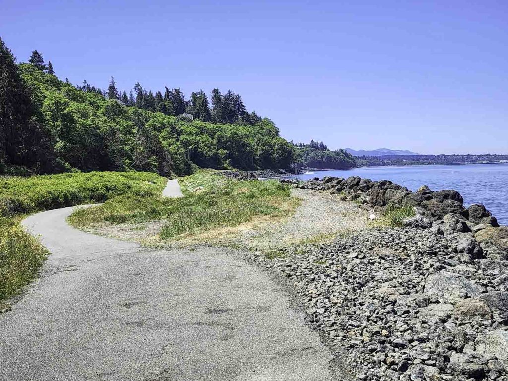
The trail progresses four miles to the Port Angeles waterfront, running right along the water’s edge, offering a wonderful view of Mount Baker to the northeast.
It passes Hollywood Beach, the city pier, and the Coho Ferry Terminal, where cars, bikers, and foot-passengers board the ferry bound for Victoria, BC. And since this is a popular trail entry point, you might encounter Trail Ambassadors—folks organized by the Peninsula Trails Coalition to maintain the pathway and assist visitors—operating what is basically a mobile visitor center for trail users.
“The ODT is a public resource,” says Jim Stoffer, coordinator of the Ambassador Program, “one that contributes to the well-being of the community, in terms of education, recreation, and good health.”
The route continues west—past the community performing arts center and the port’s boatyard, marina, and log yard—before turning southwest, heading to Crown Park. It bisects the western residential section of town, while a “spur trail” travels along the margin of Port Angeles Harbor, traversing the McKinley Paper Mill grounds and onto Ediz Hook. To the north, Vancouver Island is visible across the Strait, as well as the San Juan Islands to the northeast. This spur trail extends the three-mile length of the hook, ending at the Coast Guard Station.
“My house is close to the walkway,” says Marilyn Perkins, a Port Angeles resident, “so I’m pretty much a daily trail user, either biking or walking.” She thought for a moment and added, “I’m always surprised when I encounter people in town who don’t know about it or don’t use it. They’re missing out on a very peaceful place, especially once you’re past downtown. I walk with friends, or I walk alone—I feel safe—I’ve never had a problem on the trail.”
From Crown Park, the ODT traverses residential streets on the west side of Port Angeles, eventually becoming a conventional bike path again on the way to the bridge crossing the Elwha River. The river originates from glacial runoff in the Olympic Mountains and flows 45 miles north to the Strait of Juan de Fuca.
“I have my favorite sections of the trail,” Perkins says, “and after a while, you see some of the same people walking or biking or walking their dog, which is kind of reassuring. I usually stop and talk, and it’s funny… we don’t know each other’s names, but there is recognition. People who appreciate the ODT seem to be like-minded… and enjoying the trail gives us something in common.
“I’ve met lots of people on the trail, but there are also times when there are very few people out, or I don’t see anyone at all. Alone, I appreciate the solitude, the quiet… It’s very peaceful. I notice the foliage, the flowers, and I enjoy the changes that come with each season.”
After the Elwha Bridge, the path continues in sections from the Elwha River to Lake Crescent. This opens up the western portion of the ODT, where you’ll find an option—an adjunct trail—suitable for mountain bikers, hikers, and equestrians: The Olympic Adventure Trail. This 25-mile dirt single-track mountain bike trail feels like a hiking path deep in the forest.
The Lake Crescent portion of the ODT is known as the Spruce Railroad Trail, a four-mile, paved pathway inside Olympic National Park that hugs the pristine, turquoise-colored shoreline and is surrounded by towering Douglas Fir, Western Red Cedar, Red Alder, and Madrona. The trail proceeds west on paved roads and finally continues on the highway shoulder. From this point, segments travel far west to Forks, and eventually to the trail’s ocean-front terminus at La Push, at the mouth of the Quileute River on the Quileute Indian Reservation.
“In the early years, trail acquisition was met with resistance,” Jeff Bohman explains. “But the coalition sponsored lots of community meetings, sought neighborhood input, and worked to highlight the benefits. Over time, those benefits became apparent, and the ODT became an asset. Now it is regarded as an enhancement by landowners and realtors.” Bohman smiles and adds, “Even proximity to the trail can increase the value of property.”
Open year-round, the ODT is a trail of forest and rivers and rugged beaches, but it also traverses residential and industrial areas, making it a pathway that has a little bit of everything. “It’s continually changing,” Bohman points out, “as pieces of trail are added.” And since it’s a multi-use trail, you’ll likely encounter friends out walking, people running, other people biking, folks walking their dogs, and parents pushing baby strollers.
“The Olympic Discovery Trail does a great job of presenting the peninsula to visitors,” Bohman continues, “and of connecting people who live here. Port Townsend, Sequim, Port Angeles, Forks… if you want to get to know these communities, just get to know the trail.”
“If you walk on the trail,” Stoffer agrees, “you’ll see the community.”
And you’ll see a whole lot of the Olympic Peninsula.
 Mike Nolan is a freelance writer living in Port Angeles, WA, where the mountains meet the sea. His writing has appeared in The Seattle Times, Peninsula Daily News, and other publications. He is the author of Hardhat Days (2025, WSU Press). Visit him at mikenolanstoryteller.com.