 AdventuresNW



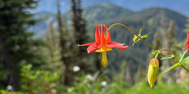
Stand on a peak in the North Cascades, and you probably can’t tell whether you’re in Northern Washington or southern British Columbia. Both sides of the Coastal Range offer prominent peaks, often highlighted by glacier and avalanche lilies in the spring, yellow arnica and crimson paintbrush at the height of summer, and an abundance of indigo-hued blueberries in the early fall. But there’s a difference between the two locations, and that mostly comes down to crowds. Travel east on the Baker Highway to any number of trailheads, and you’re likely to meet plenty of other hikers in search of the same challenging climbs and worthwhile vistas. Travel east on British Columbia’s Highway 1 to the Chilliwack River Valley, and you may be the only person within miles.
What the road lacks in access, the mountain gains in peace.
As a dual citizen of Canada and the United States, I’ve lived on both sides of the border. I don’t claim to prefer one over the other, and I plan on hiking and running routes on both sides this year. But if I were looking for the quieter side, I’d stay in Canada. Within 10 days, my husband, Nick, and I summited three of Chilliwack’s best hikes. The abundance of wildlife we observed, even on the drives to the trailheads alone, far surpassed the number of fellow hikers.
Here are three great options for hikers and runners on the “quiet side”.
Mount MacFarlane
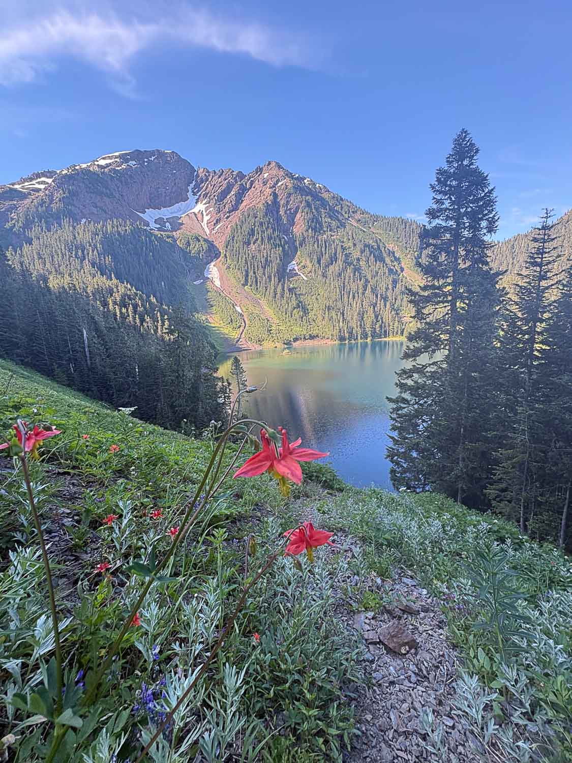
Of the three hikes, Mount MacFarlane is the busiest. Taking advantage of the cool morning temperature, our hike started at 6:30 a.m. on a late June day. While Nick and I typically run most of these mountains as part of training for ultramarathon races, we decided to turn this into a hike in order to bring our dogs, Cashew and Mohi.
The initial few steps are nothing spectacular, just a forest service road (FSR) framed by thick cedars overhead. Soon enough, a small sign indicating the start of the trail appears on the right. Take that, and you’re almost immediately climbing upward through forests of ferns and rounding steeply pitched switchbacks. Our hiking poles were essential to assist us in the unrelenting grade.
Within a few kilometers, the forest began to shift: swaths of salmonberries blanketed the trail and cow parsnip leaves brushed our arms. We paused to filter water at the first big stream, then gingerly crossed the log-turned-bridge, complete with a railing.
After passing through denser brush, the trail steepened, sometimes seeming endless, over roots that stretched across our path and finally entering a meadow. Our timing was just right: at this time of year, the meadow was bright with tiger lilies and fireweed, accentuated by the cerulean waters of Lower Pierce Lake. An offshoot trail leads to the shore, but we decided to continue on toward the top, where the views would be even better.
The dry trail of the meadow led back into forest before orange flags marked our way through a boulder field. Our larger dog, Mohi, nimbly picked his way through, while Nick assisted our smaller dog, Cashew. Scampering pika shrieked their alarm at us before darting back into the crags—the perfect time to catch our breath and admire the view of the Fraser Valley below.
After snapping a few photos, we picked our way through heather, its magenta flowers just beginning to bloom, finally reaching Upper Pierce Lake. If there’s one place for hikers, runners and backpackers alike to congregate, it’s here at the lake’s shore. Some stop to filter water, others to camp. Some even brave a shocking dip on a hot day. We chose to keep the momentum going and made our way toward the summit.
The summit of Mount Macfarlane is best suited for the sure-footed: the final climb is a steeply pitched ridge hike with a few scrambles. We took our time here to ensure we were following the correct way up. At times the route requires a bit of hand-over-hand scrambling, but the majority is hikeable, even with a leashed, adept dog.
From the summit, the cold waters of Upper Pierce Lake lay below, and the panoramic vistas showcased the range of mountains on both the American and Canadian sides: Shuksan, Larrabee and the Border Peaks in the United States and the Cheam Range to the north. The sharp peak of Slesse is particularly imposing and best left to experienced climbers. We enjoyed a snack of sourdough bread with almond butter and raw honey (plus dried salmon treats for the dogs) before beginning the journey back down.
Our total people sightings for the day? Three.
Mount McGuire
On the morning of my 34th birthday, Nick and I woke at dawn, packed our car, and headed back to Chilliwack Lake Road; parking not far from the MacFarlane trailhead, on the new Borden Creek FSR. While it was once possible to drive further up the FSR to the trailhead, a 2021 atmospheric river destroyed a bridge over Borden Creek, significantly increasing the length of the hike. That didn’t bother us, however. As ultra runners, we enjoy more mileage, and began our day just off Chilliwack Lake Road.
The start is well covered by alders and maples, but soon transitions to more exposed road. A tough workout for us was evident as the first mile climbs 600 feet. While the views wouldn’t come for several more miles, there was wildlife to admire: a pair of red-breasted sapsuckers alighting on the thin stem of an alder; a moment later, two baby grouse darting across the road. Our coo of appreciation flushed an adult grouse from the forest. Because it was early in the season, there were several creeks to cross. We noted their locations—we’d be thirsty and need to filter water on the way down.
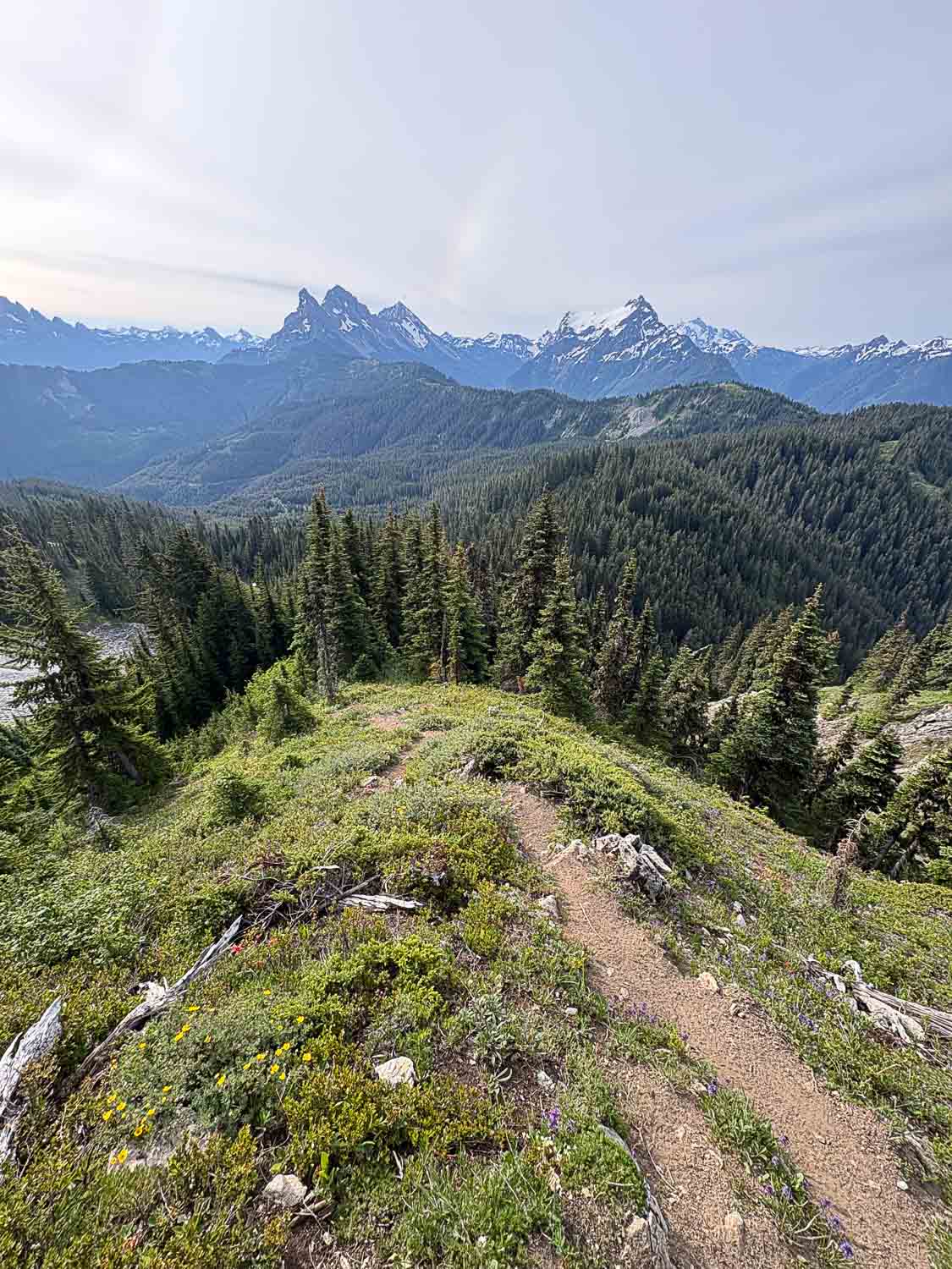
After seven miles of running uphill, we finally turned off the FSR and onto the beginning of the McGuire trail. The early section of the trail was difficult to find, and I was grateful that we’d downloaded the GPX route beforehand, just in case. Whereas trails in the Mount Baker area are well-marked, the Chilliwack River Valley gets far less traffic, and trails are often noted by little more than a small orange blaze. Once ensuring the trail was the correct one, we began crossing a meadow on par with the slopes of Church Mountain on the other side of the border. Western tiger lilies, lupine, and broadleaf arnica brightened the otherwise soft green field. Here the trail was smooth and relatively easy, but that would quickly change.
As the trail steepened, chunks of limestone, a unique feature of Mount McGuire, became visible. Very few of the surrounding mountains share this trait. McGuire is also known to have limestone caves, but that adventure could be saved for another day.
Approaching the final mile, we mentally prepared ourselves: from here to the summit, a more than 1500-foot climb. As we pushed off of our quads, often grabbing onto an outstretched branch for support, our breathing quickened, and our calves began to burn. In late June, wildflowers were at their peak, and our suffering was buoyed by the patches of vibrant colors surrounding the trail. Phlox, Columbine, arnica, violets, and pasque flowers served as tiny trail markers, leading us toward the summit.
We carefully traversed over the final block, which requires a grade 2 scramble. The limestone was strong, and we felt comfortable navigating this one exposed section. Not surprisingly, the views were worth the effort. From here, the close views of Canadian and American Border Peaks and the snow-covered slab of Tomyhoi were breathtaking.
While it’s possible to reach the summit from the north, I suggest taking the approach out and back from Borden Creek. Without a rugged 4×4, it’s a long day, but well worth the effort.
Mount Cheam
Of the mountains accessible from the Chilliwack River Valley, Mount Cheam is perhaps the easiest—at least by foot. In the past it was possible to gain 4,000 feet of elevation to the trailhead, making the hike just over five miles round-trip. That’s no longer the case, as several washouts have made the forest service road all but impassable to vehicles. However, what the road lacks in access, the mountain gains in peace.
In early July, we left our house in the Fraser Valley and arrived at the Chipmunk FSR an hour later. Along the way, a black bear appeared picking its way through a patch of alders, and a large flock of evening grosbeaks flew past our car. From the turnoff to Mount Cheam FSR, it was a guess as to how far our Subaru Outback would make it. Within two and a half miles, after navigating over enough washouts, we determined stopping here was the right call, parked on a small pull-out and readied our packs.
From the start, the FSR climbs sharply. We ran some sections and hiked others, enjoying the sounds of hermit thrush and warblers in the trees above us. Magenta foxgloves lined the edges of the road and every half mile or so we’d pass another creek, reassuring us there was plenty of water to filter on the way back down.
Climbing higher, the mountains appeared sharply around us. Our pace quickened in anticipation of getting closer to Mount Cheam itself. At six miles, we reached the parking lot and began the official Mount Cheam trail.
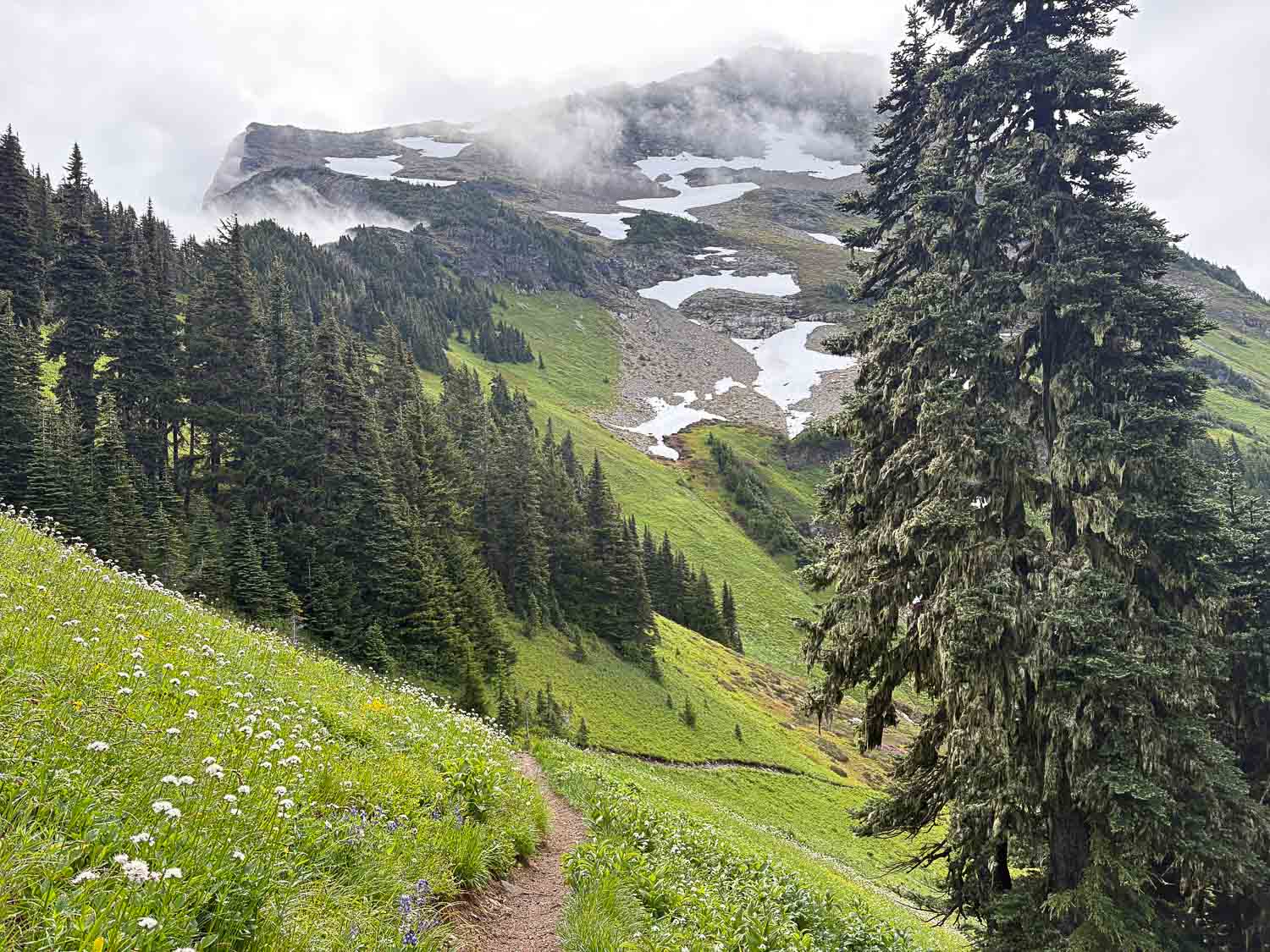
At the Mount Cheam trailhead, it was clear that what sets this route apart from others in the region is the gorgeous meadows. Most of the trail curves up through lush green, thick with patches of corn lilies, more akin to what is experienced on Washington’s Church Mountain. On warmer days we’ve stopped at a small pond for a frigid jump in, but this time the two of us chose to carry on, the cloud cover keeping temperatures lower than normal.
We made quick time through the meadow, pausing only to admire crimson paintbrush and the spindly stems of arnica. Unlike most other hikes in the area, Cheam’s trail is delightfully smooth. In the final half mile, the grade steepened. Here the trail changed from smooth dirt to rocks, the glacier lilies disappearing. We followed clumps of purple heather and lilac phlox upwards, finally seeing the full Cheam range open up to our right: Lady, Knight, Baby Munday, Stewart, The Still, Welch and Foley Peaks. Immediately to our left lay the Fraser Valley, including Harrison Lake, far below. I watched a pika scamper across a rock field and a gray-crowned rosy finch hop along the upper slope of Cheam.
On our way back down the trail, I listened to MacGillivray’s warblers and Black-headed grosbeaks. I noticed my own breathing, and Nick’s, too. I heard our footsteps as we ran down the mountain and back along the forest road. It wasn’t quiet, per se, but this was my kind of quiet.
The Routes
- Mount Macfarlane: 10.6 miles round-trip with 6200 feet of ascent.
- Mount McGuire: 17.6 miles round-trip (from the start of Chilliwack Lake Road) with 6,000 feet of ascent.
- Mount Cheam: 5.6 miles round-trip with 2200 feet of ascent. If starting at mile 2.5 of Foley Forest Service Road, the round-trip is closer to 14 miles with 5300 feet of ascent.
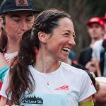 Jade Belzberg is a professional trail runner living on the Canadian side of the beautiful Pacific Northwest. She writes about her races, adventures, and life with twenty rescue animals on her Substack, The Thread.
Terrific article and amazing adventures!